
Google Earth
Google LLC
Installs
500M+
Developer
Google LLC
-
Category
Travel & Local
-
Content Rating
Everyone
Developer Email
Privacy Policy
http://www.google.com/policies/privacy
Screenshots
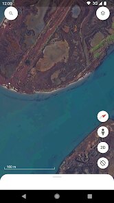
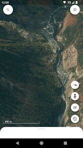
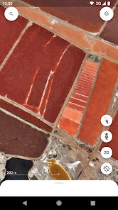
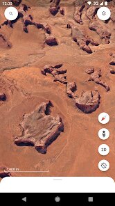
Expert Review
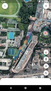
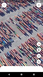
Among the various mapping applications available on the market, Google Earth, developed by Google LLC, holds a distinctive position. Rather than serving purely as a navigation tool, it functions as a comprehensive virtual globe, offering satellite imagery, 3D terrain data, and detailed geographic information. The application is readily available for download through the Google Play Store and the Apple App Store, completely free of charge. While the base version incorporates a modest amount of advertising and optional in-app purchases for advanced features, the core experience remains entirely accessible to all users. The sheer scale of its installation base reflects its popularity as a premier educational and exploratory tool.
Navigating the app reveals a well-structured interface where users can zoom from a global perspective down to street level with impressive clarity. The main function revolves around an interactive map that responds smoothly to touch gestures, allowing for seamless panning and rotation. One can explore the 3D buildings feature in major cities, observe the topography of remote mountain ranges, or utilize the time-lapse function to witness environmental changes over decades. From a personal standpoint, the layer that displays user-generated photos and Wikipedia entries linked to specific locations adds an unexpected depth to casual exploration, transforming simple map viewing into a richer learning experience.
A significant factor that distinguishes Google Earth from standard navigation apps like Google Maps or Waze is its intentional focus on comprehensive exploration rather than point-to-point direction. Traditional map apps prioritize efficient routing and real-time traffic information, whereas Google Earth emphasizes a broader, more educational perspective of the world. The interface feels distinctly different, leaning more toward an interactive atlas than a practical travel companion. In my observation, this fundamental difference in design philosophy means it does not compete with daily commute apps but instead complements them by offering a way to understand the 'why' behind a location, not just the 'how' to get there.
Key Functional Highlights
- The built-in Voyager feature presents curated interactive stories and guided tours from various creators. It transforms the globe into a storytelling medium, covering topics from natural wonders to cultural heritage sites. This feels considerably more polished than similar content found in competing education apps, offering a unique blend of journalism and cartography.
- Measurement and ruler tools provide a practical layer for professionals and enthusiasts, allowing precise distance and area calculations between any points on the map. Although a niche functionality, its accuracy and ease of use make it invaluable for planning trips or understanding geographic scales without pulling out separate calculation software.
- An offline map caching system works well in areas with poor connectivity. Downloading a specific region for later viewing functions flawlessly, though it does not support the dynamic 3D layers entirely. Still, for preparing explorations in remote locations, this feature exceeds the often-limited offline capabilities of other mapping services.
Advantages & Benefits
- Accessing decades of historical satellite imagery is extremely straightforward, clarifying how landscapes and urban centers have developed over time.
- Street view integration provides a ground-level perspective that, when combined with the aerial overview, aids tremendously in understanding any unfamiliar place before traveling there.
- Sharing locations and custom maps via simple links ensures that collaboration for trip planning or academic projects involves minimal friction and immediate clarity for all recipients.
Areas for Improvement
- Battery consumption remains notably high during extended 3D exploration sessions, meaning an external power source is almost necessary for sustained tablet use.
- Occasional loading delays occur when rapidly zooming between distant locations, breaking the fluidity of the exploration experience in bandwidth-limited environments.
- The sheer density of information across different geographic layers can crowd the screen UI, sometimes making it slightly difficult for new users to immediately locate the specific view they want to activate.
Recommended Apps
![]()
ZEPETO: Avatar, Connect & Play
Naver Z Corporation4.3
![]()
Reverse Voice: Flip Singing
NindaFuit0![]()
AI Chat Ask Assistant - NowAI
Now Tech4.3![]()
Lie Detector Test: Prank App
DkTech inc.4.3![]()
Peachy - AI Face & Body Editor
InShot Video Editor4.8
![]()
AI Video Art Creator - Livensa
FERASET4.5![]()
Google Voice
Google LLC4.3![]()
Horoscopes & Tarot
Astrolis Horoscopes4.7![]()
eBay online shopping & selling
eBay Mobile4.6![]()
JPay
Jpay Mobile4.1![]()
Stranger Things 5 Challenges
MVH Entertainment Team5![]()
Chat Master: Prank Story
ABI Game Studio4.8![]()
Google Maps
Google LLC4.2![]()
AI Chat・Ask Chatbot Assistant
AI Chat Studio4.5![]()
Name Meanings with Impact
Alif Innovative Solution3.7














You May Like
-
![]()
True Tarot Card Reading
KaApps4.2 -
![]()
LinkedIn: Jobs & Business News
LinkedIn4.2 -
![]()
iControl: Easy Widgets Themes
Fancy keyboard for theme apps4.6 -
![]()
Duolingo: Language & Chess
Duolingo4.7 -
![]()
Flipped:Chat with AI Character
First Group pte ltd4.1 -
![]()
Hearing Age
Mobile Solutions Tech0 -
![]()
TikTok
TikTok Pte. Ltd.4.4 -
![]()
Pretty Makeup - Beauty Camera
Photo Editor Perfect Corp.4.4 -
![]()
PhotoRoom AI Photo Editor
PhotoRoom Background Editor App4.7 -
![]()
Lightleap by Lightricks
Lightricks Ltd.4.3 -
![]()
Name Meaning
Dexati4.1 -
![]()
Truth Social
T Media Tech LLC3.3 -
![]()
Ace Hardware
Ace Hardware Corporation4.7 -
![]()
Kpop Fans Demon Hunter Wallpap
JHNStudio4.3 -
![]()
Artplay - AI Photo & Video
Hideaway Technology Limited4.5